
Difficulty: High.
Duration: 3:30h/4h.
Distance: 9.5 km.
Observations: Path not marked.
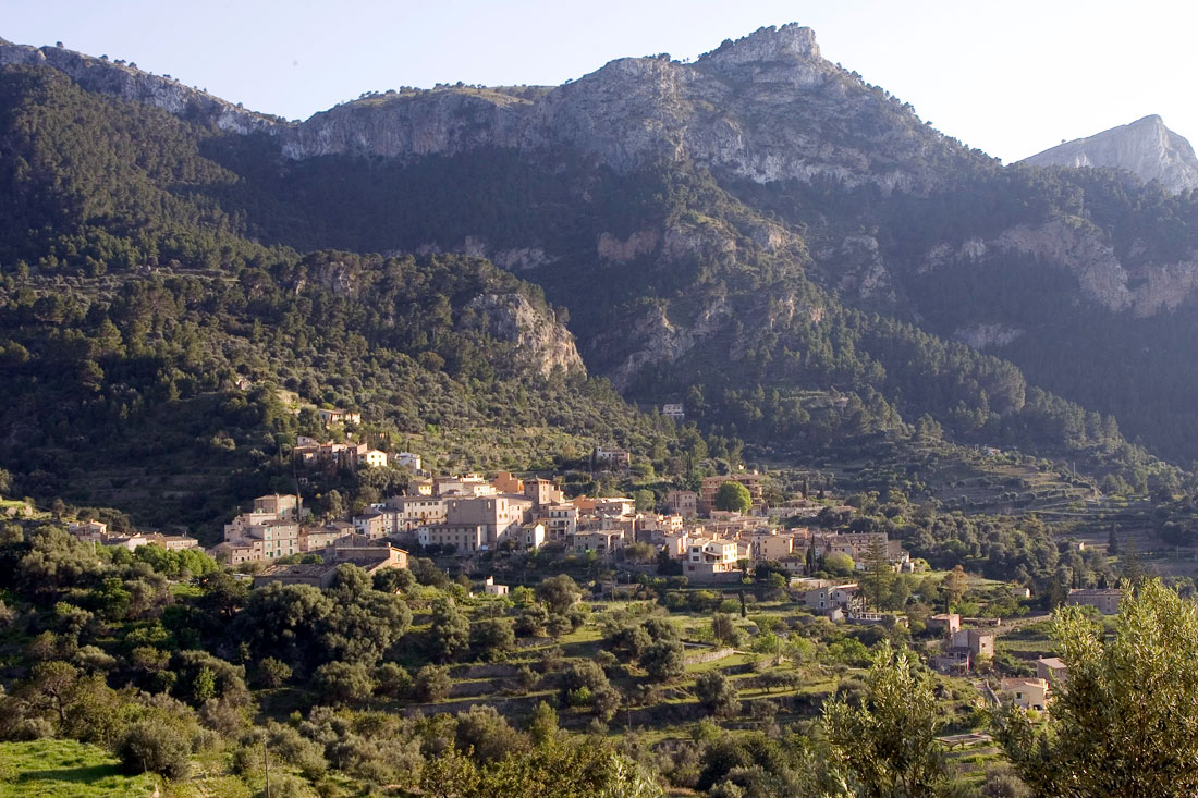
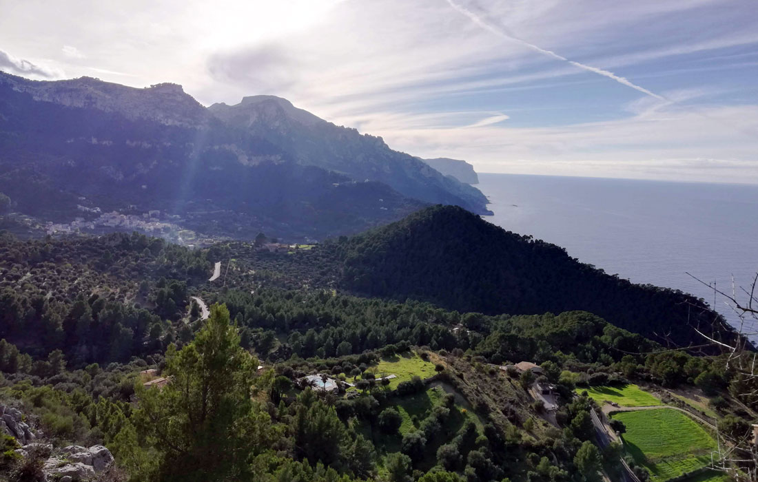
This route starts close to the wash houses of Estellencs and follows the Camino Real or Royal Path. Following this path you'll soon see the houses of Son Fortuny in the distance.
Further on, leaving the woodland path behind, we reach Coll d'Estellencs, the highest point on the route (652 m). The route then continues until the main road PMV-1101, which leads just a few metres afterwards to the town of Puigpunyent.
Dificulty: High.
Duration: 6h.
Distance: 11.1 km.
Observations: Circular route with milestones.
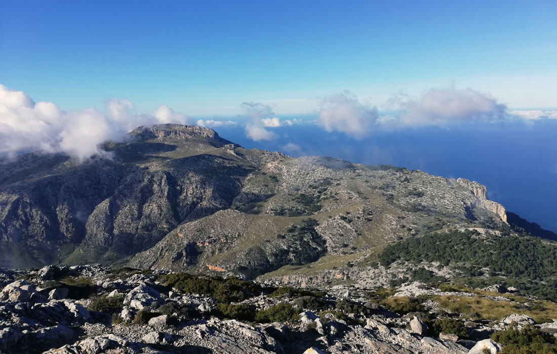
Puig Galatzó is a mountain full of history and symbolism for the different civilisations that have populated Mallorca and is also the highest point in the west of the island.
The route to reach the peak starts at the woodland path that leads to the public estates of Son Fortuny and Sa Coma d'en Vidal, going up to the recreational area of Boal de Ses Serveres. From here, we follow the signposted route and, once at the top, can enjoy the wonderful views both of Estellencs and almost all the island of Mallorca.
Dificulty: Low.
Duration: 50 min.
Distance: 3.2 km.
Observations: Circular route. Family route.
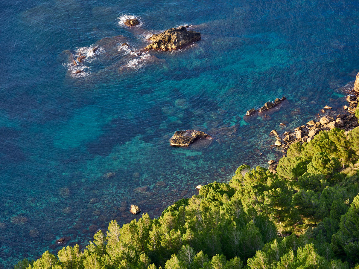
This is the brief circular path, going down from the town to Cala Estellencs. This short route makes the most of the area's countryside and, once we reach the bay, we can see the characteristic coastline of the Serra de Tramuntana and particularly its high cliffs. In the bay we can also see the "scars" or piers, small refuges for the traditional fishing boats.
Dificulty: Medium/low.
Duration: 4h.
Distance: 8.2 km.
Observations: Extreme caution, the road disappears during the ascent.
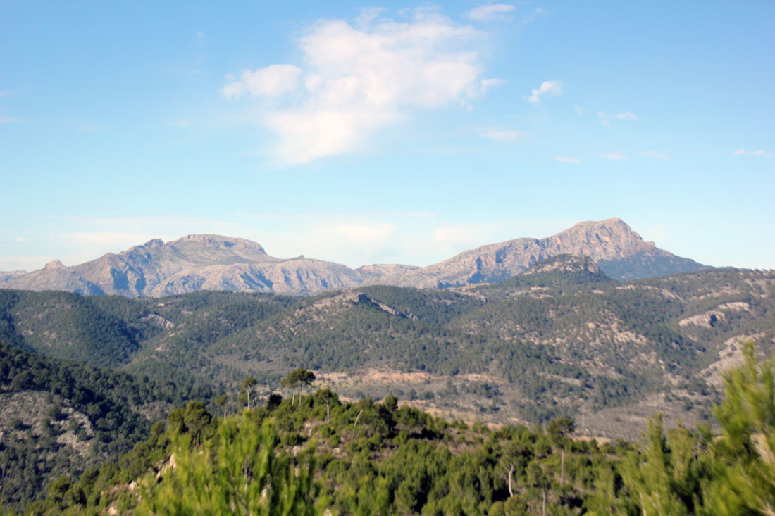
The route to reach the summit starts at the woodland track that leads to the public states of Son Fortuny and Sa Coma d'en Vidal, going up to the recreational area of Boal de Ses Serveres. Throughout the ascent you can enjoy spectacular views of the Estellencs coast and, with a bit of luck, even see a Booted Eagle (Hieraaetus pennatus).
At the top are the ruins of the small observatory where the astronomer Dominique François Arago, stayed in 1808 during his work to measure the terrestrial meridian arc between Catalonia and the Balearics.
The Dry Stone Route (GR 221) runs along the whole Sierra de Tramuntana mountain range from Andratx to Pollença, with a total of 18 stages and 9 variants. The route displays the different landscapes, heritage, customs and all the charms of this area declarated of Human Heritage by UNESCO.
The sections of this long route that run through Estellencs are stage 2, La Trapa - Estellencs (currently being developed) and also Variant B, which links the towns of Es Capdellà and Estellencs. The Postal Path (Camino del Correo) also forms part of the GR 221, joining Estellencs with Banyalbufar.